


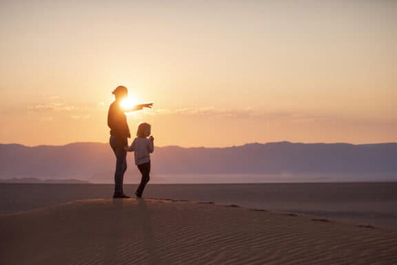
There’s more to Namibia than endless towering sand dunes and a coastline littered with shipwrecks. Take a closer look and you’ll discover a world of natural and man-made landmarks and monuments.
From spectacular waterfalls and dramatic canyons to a number of large meteorites and geological formations, this part of the world is endlessly fascinating and packed full of things to see. If you’re planning a Namibian safari holiday, don’t miss out on this comprehensive guide to the country’s most notable attractions.
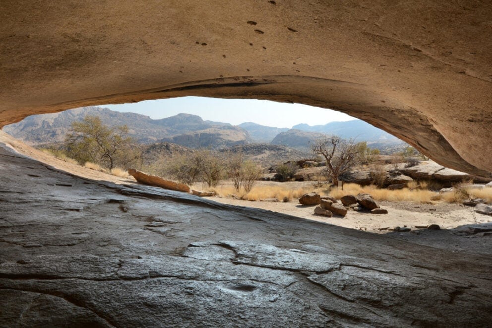
Bogenfels Arch
The Bogenfels rock arch is a towering lime rock in the formation of a bridge. This natural geological curiosity is situated at the south Atlantic coast in the middle of the Restricted Diamond Area around 100 km south of Lüderitz.
Although Bogenfels Arch is in a restricted zone, there’s a tour operator in Lüderitz who holds a concession for the area and offers a variety of tours. You can’t drive directly to the site, but the short walk down to the weather-beaten spectacle is rewarding. While you’re in the area, don’t miss out on the ghost towns of Pomona and Elizabeth Bay.
Brandberg
The Brandberg Mountain Range is located in the Erongo region in the west of Namibia and is Namibia’s highest mountain. The mountain range has an average height of 2500 meters. Brandberg gets its name from the glowing colors that the setting sun paints across it which give it the appearance of being on fire.
The closest town is Uis, which is situated about 30 km away and offers overnight facilities.
Brandberg is renowned for its numerous rock paintings. Scientists are sure that these paintings were done by the San (Bushmen) who inhabited the area thousands of years ago. Besides depictions of warriors and hunters, a large amount of animal paintings can be found, indicating that this area was once abundant with wildlife.
Cape Cross
Cape Cross features a historical landmark where Diego Cão landed in 1486 as the first European, as well as a very large Cape fur seal colony. In 1485, King John II (João II) of Portugal instructed the sailor Diego Cão to sail south along the west coast of Africa in search of a sea route to India.
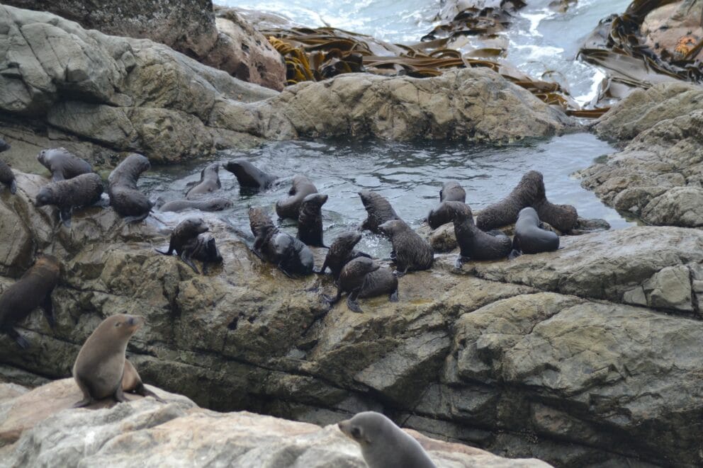
Further, his task was to document and capture unknown terrain for the Portuguese crown. He reached Cape Cross (about 120 km north of Swakopmund) and erected a stone cross. The site is also home to over 100 000 Cape fur seals.
Duwisib Castle
About 70 km south west of the small town of Maltahöhe, Duwisib Castle rises like a red sandstone mirage from the desert, complete with a defense tower and battlements. The castle was built by the German Officer Baron Hansheinrich von Wolf, who came to Africa during the Herero War.
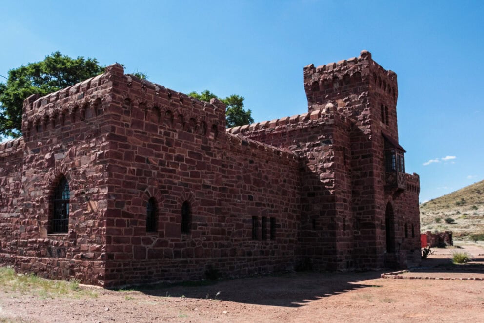
Von Wolf married a wealthy American in 1907 and decided to stay in Africa to breed horses. He enlisted in the First World War but died tragically in France in 1916. After his death, his wife didn’t return to Africa and the castle and its accompanying stud farm fell into disrepair.
The state bought the property in 1978 and in 1991 the castle was renovated and declared a national monument.
Epupa Falls
The Kunene, the border river between Namibia and Angola, plummets down a 40 m deep gorge creating the Epupa Falls near the village of Epupa. Although the Kunene River is one of Namibia’s five perennial rivers, its water level changes depending on the annual rainfall, so Epupa Falls is subject to seasonal fluctuations.
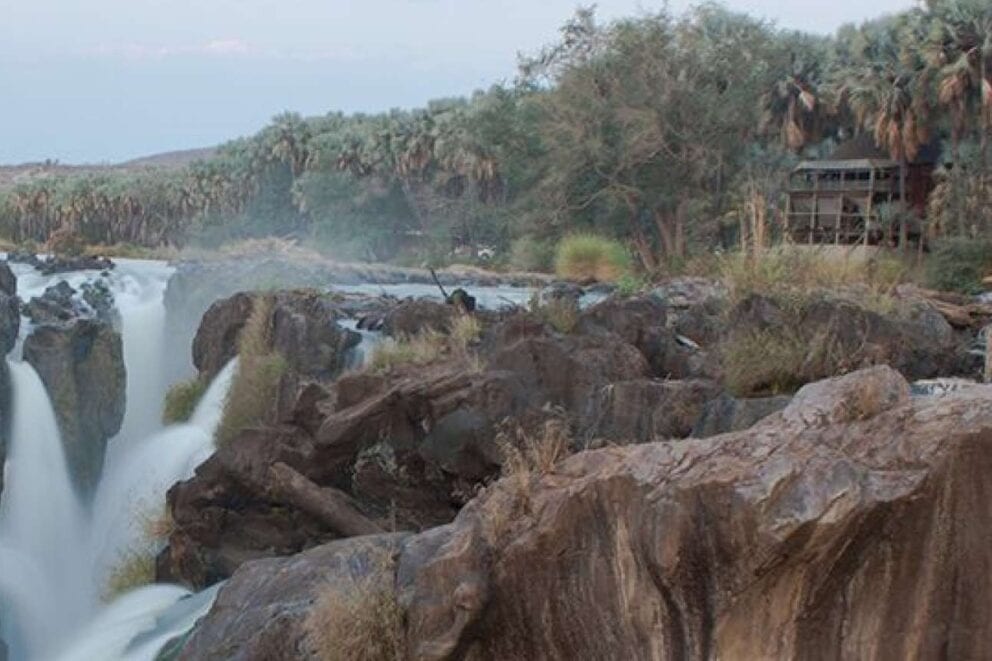
The best time of year to view the falls is April to May. The Epupa Falls can be reached via Opuwo on the C43. It’s a good idea to top up on fuel, water, and food in Opuwo as there’s not much shopping to be done in Epupa. For 4×4 enthusiasts, the road along the river between Epupa and Swartbooisdrift is challenging even for experienced drivers.
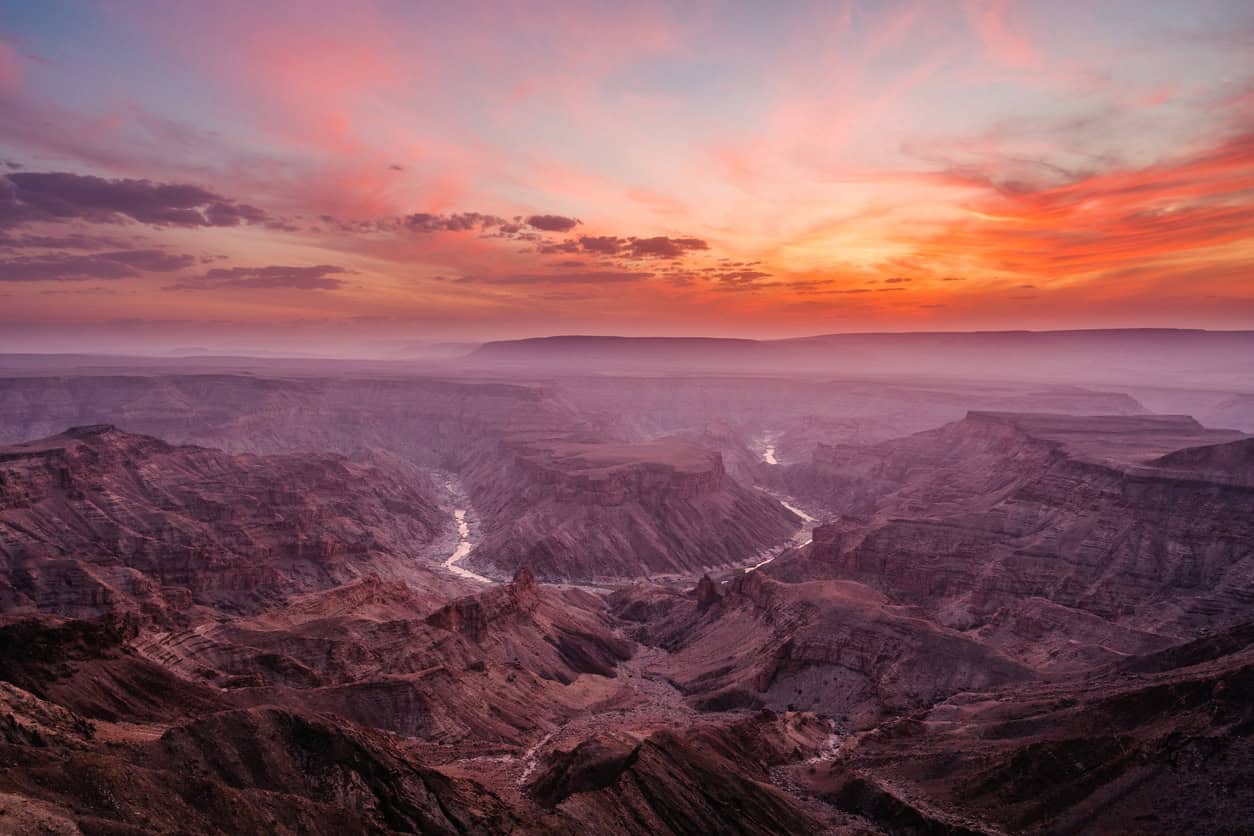
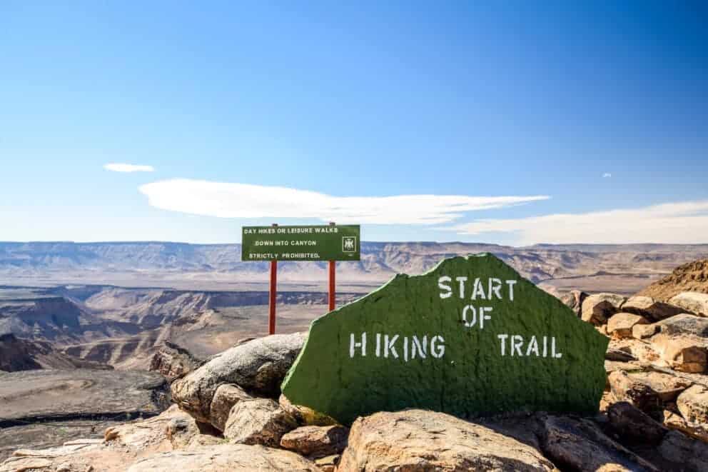
Fish River Canyon
After the Grand Canyon in the USA, the Fish River Canyon is the second largest canyon in the world and forms part of the AisAis Richtersveld Transfrontier Park. The entrance to the park is located 10 km from the renowned Hell’s Bend viewpoint at the Hobas Rest Camp.
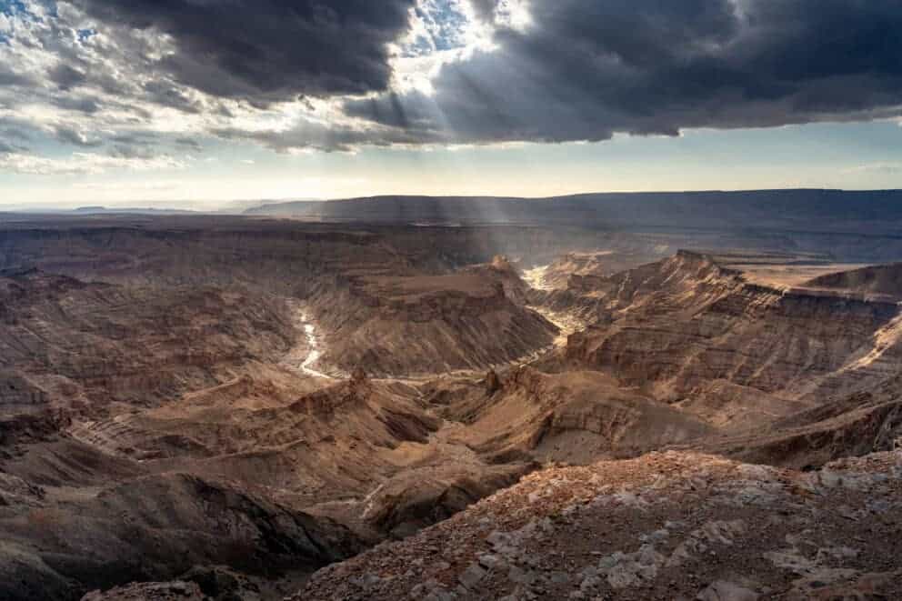
During the summer months the canyon is closed due to the heat but Fish River Hiking Trail is open from April to September. The trail can be completed within 4-5 days, depending on fitness levels. It’s 85 km long and the descent into the canyon is only allowed for hikers doing the trail.
The Fish River Canyon starts at Seeheim, is 161 km long, 27 km wide, and up to 550 m deep. The canyon ends at Ai Ais and the river then flows into the Orange River at the border of South Africa.
Gross Barmen
Situated 100 km from Windhoek and 24 km east of Okahandja is the Gross Barmen Hot Springs resort. The hot mineral springs here have a temperature of 65 °C but they’re cooled down to 40 °C in the thermal pool. The resort was built close to the former Rhenish mission station.
The former mission was converted into a thermal bath in 1975. Water is pumped from a depth of 2500 m into an indoor and outdoor pool.
Hoba Meteorite
Experts agree that the Hoba Meteorite is the largest meteor that has been found on the planet. The meteorite fell about 20 km west of Grootfontein around 80 000 years ago and weighing 50 tons hasn’t ever been moved.
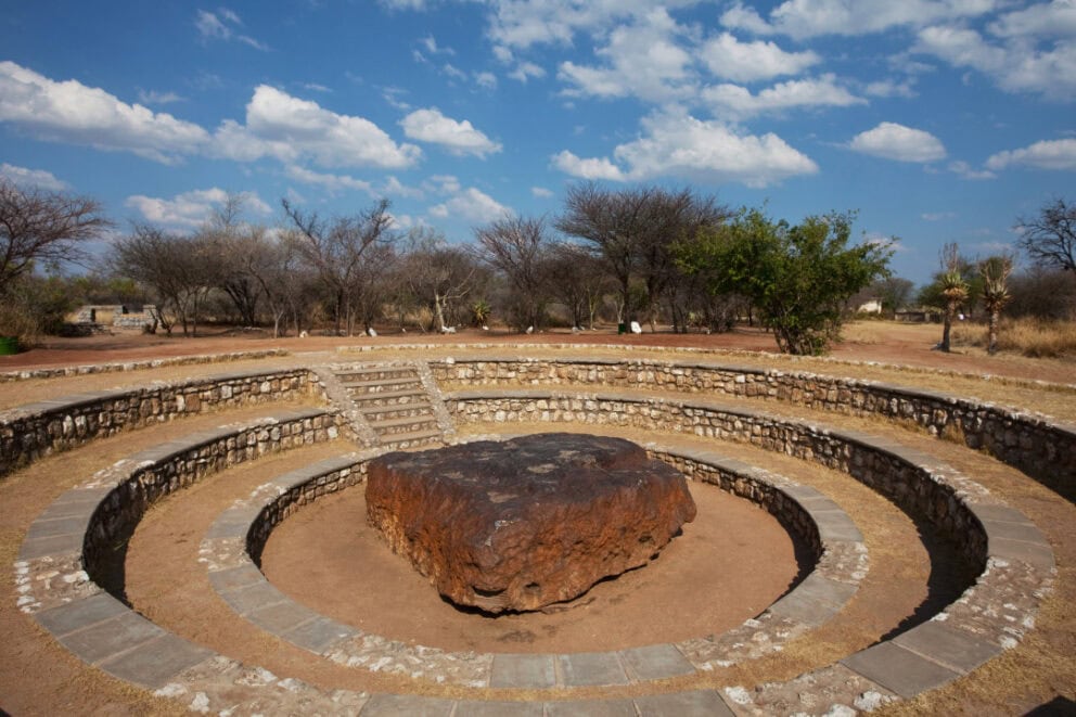
It’s estimated to be between 200 and 400 million years old and is mostly iron (82%), nickel (16%) and some trace elements. Its name comes from the Hoba Farm in the Otavi Mountains. The Hoba Meteorite was declared a national monument in March, 1955, and the area around it was donated to the National Monuments Council in 1987.
Kolmanskop
Located 15 km east of the harbor town of Lüderitz, Kolmanskop was once a small railway station, when the railway between Lüderitz and Keetmanshoop was built.
In 1908, a railway worker found a shiny stone and took it to the chief railway foreman, August Stauch, a hobby mineralogist who had asked his workers to bring him any unique stones they found. After the stone had been examined by a mining engineer, it was confirmed to be a diamond.
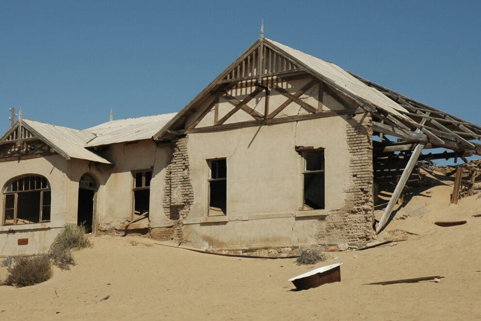
Staunch quit his job, secured a claim at Kolmanskop, and successively continued his search for diamonds. Word traveled fast and within two years a town developed at rapid speed, quickly becoming the richest town in Africa.
The southern coastal strip was declared a restricted diamond area and diamond mining was industrialized. With the outbreak of war in 1914, the production fell to nearly zero and with the loss of the German Colony, the German Era of diamond mining came to an end and was supplanted by South Africa.
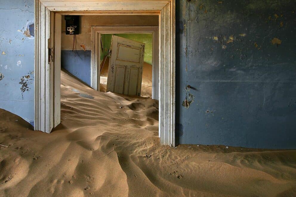
In 1928, profitable prospecting sites were discovered south of Lüderitz. As the deposits around Kolmanskop were nearing depletion, mining activities were discontinued, and by 1938 all machinery was taken south. The town was left to be reclaimed by the desert, with the last resident leaving between 1956 and 1960.
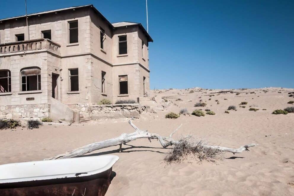
In 1980, Lüderitz underwent an economic boom and the tourist potential of the ghost town was rediscovered. Some houses were dug out of the sand and restored, and today visitors can take guided tours of the site.
Lake Otjikoto
If you’re traveling on the B1 from Tsumeb towards Etosha National Park, you won’t have to detour far to find Lake Otjikoto, one of Namibia’s highlights. Otjikoto translates to ‘deep hole’ and the depth of the lake has been measured at 145 m.
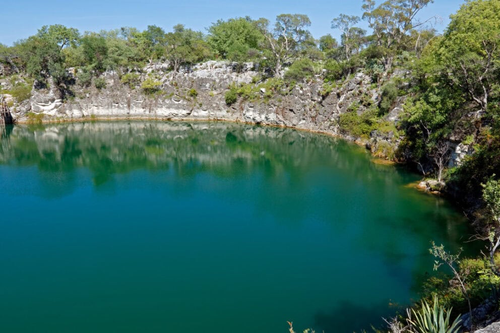
The lake contains a large quantity of arms and ammunition, left by German troops before capitulating to South African superiority in 1915. Otjikoto is open to diving clubs and some of the recovered weapons have been carefully restored and are on display at the Tsumeb Museum.
Windhoek Diving Club has established an underwater museum, displaying some of the weapons on a ledge.
Naukluft Mountains
The Naukluft forms part of the Great Escarpment and the Namib Naukluft Park, one of the most important National Parks in Namibia. This mountain range is located at the eastern edge of the Namib Desert between Sesriem and Solitaire, and reaches an overall height of 2000 m above sea level.
Most of the Naukluft is made up of limestone and dolomite. The range is characterized by its deep and narrow gorges. More than 50 mammal and over 200 bird species are found here, mainly due to the abundance of water in the region.
Only one accommodation facility can be found within the central area of the Naukluft Mountains: the Naukluft Camp, run by Namibia Wildlife Resorts. Visitors here can either camp or stay in one of the six available bungalows.
Petrified Forest
Situated about 50 km west of Khorixas, the Petrified Forest was proclaimed a national monument in 1950, after being discovered by two farmers in the 1940s. The site features an accumulation of massive fossilized tree trunks over 280 million years old.
Over a period of millions of years, even the finest structures of the wood have been dissolved by silicic acid and replaced by quartz.
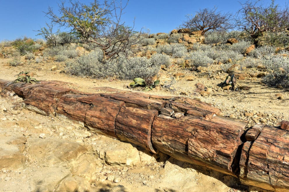
The result is perfectly conserved and completely petrified tree trunks. Geologists researching the trunks have discovered that the trees belong to the Cordaites family, which grew very long ago in today’s Europe and was the ancestor to spruces and firs.
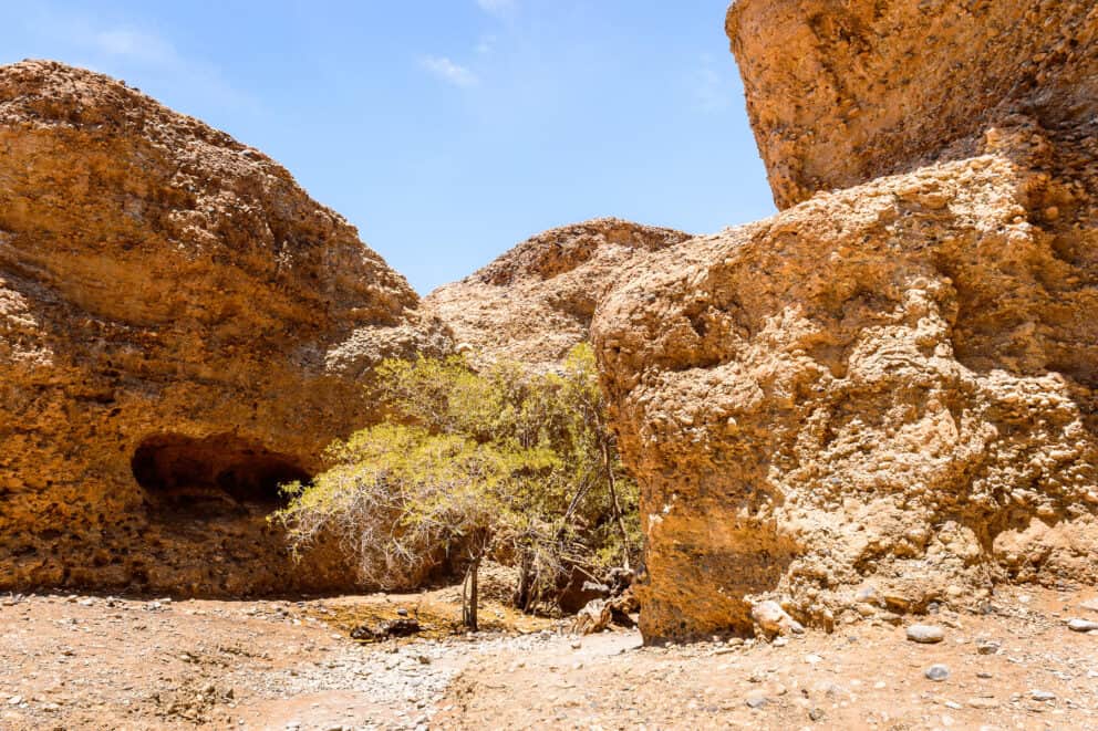
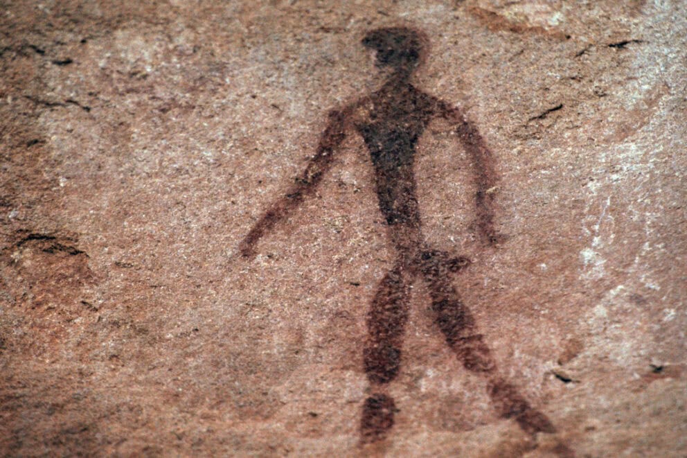
Philip’s Cave
Located on farm Ameib in the Erongo was likely once a San dwelling. Stone tools dating back to 3500 years BC have been found here. Before the importance of the rock paintings at the Brandberg Mountain, the paintings in Philip’s Cave were possibly the most important testimony of rock art in the north-west of Namibia.
The most renowned painting is the ‘White Elephant’, inside which a small red antelope has been drawn. Drawings of giraffes, rhinos, ostriches, springbok, kudus, and six hand imprints can also be found here.
At least two hours should be planned for the walk to the cave. It’s advisable to visit the cave in the cooler morning hours and to take plenty of water for the visit.
Quivertree Forest and Mesosaurus Fossils
Visitors to southern Namibia will come across a fascinating point of interest near Keetmanshoop.
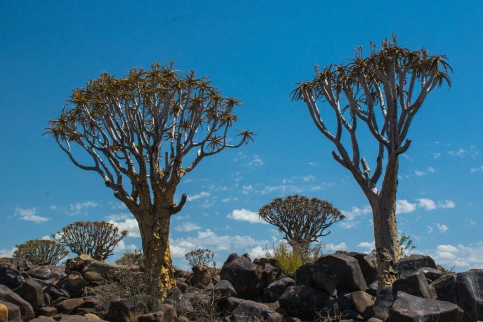
Here they will find the large Quivertree Forest with thousands of quiver trees, close to a piece of land where a number of Mesosaurus fossils have been found. In addition, you’ll find a picturesque dolerite rock field.
Price on Request ';
$3095 USD
$3582 USD 10 DAYS ';
$3457 USD
$3710 USD 


Restricted Diamond Area
Also known as the Sperrgebiet National Park, the Restricted Diamond Area stretches from the southern border of the Namib-Naukluft National Park to the Orange River, the border between South Africa and Namibia. It covers an area of 26 000 km² and is crossed by the national road B4 from Keetmanshoop to Lüderitz.
The road to Lüderitz is open to the public but you’ll need a permit to visit Kolmanskop. This also applies for visits to Oranjemund further south.
Today, mining activities are concentrated on the Atlantic at the Orange River estuary, and some of the strict entrance restrictions were nullified with the proclamation of the Sperrgebiet National Park in 2008.
Ruacana Falls
Ruacana Falls have their origin in the Kunene River, the border river between Namibia and Angola. Close to the village of Ruacana, the Kunene bends sharply to the west until it flows into the Atlantic Ocean at the Skeleton Coast. At Ruacana, the Kunene plummets into a 120 m deep and 700 m wide gorge, forming the impressive Ruacana Falls.
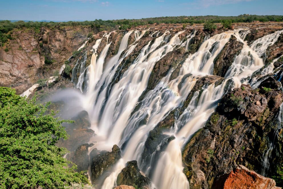
Two hydro-electric plants have been built here, the bigger of the two in 1970 by South Africa. The full strength of the falls can best be experienced during high water in April and May. Canoe rides and whitewater rafting can be booked at the lower course of the river.
Sandwich Harbor
42 km south of Walvis Bay, you’ll find Sandwich Harbor. The name refers to the former harbor as well as the lagoon. You’ll only be able to reach this destination in a 4×4 vehicle, but you can take guided tours from Walvis Bay.
Founded in 1486 by Portuguese sailors, there are claims that the harbor was a moderately sized commercial port based around whaling and small-scale fishing in the 19th century.
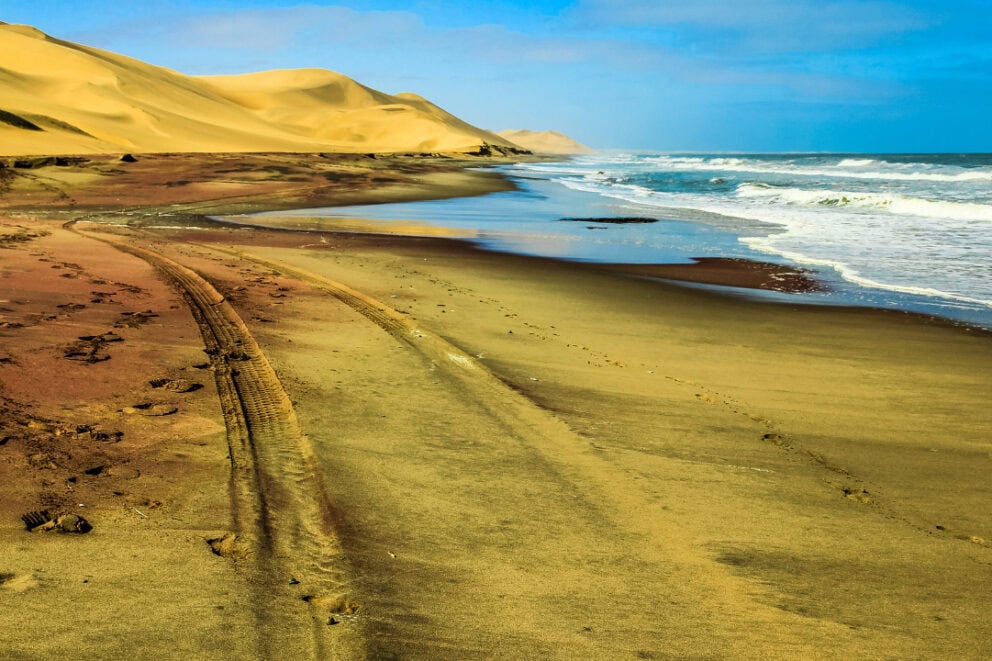
In 1884, the remote harbor gained importance as a supply point for the German colony South West Africa. The lagoon used to be an oceanic bay, but silted up to the point where it became completely surrounded by sand and reeds.
Today the main attraction here is the incredible abundance of birdlife, featuring up to 200 000 birds including terns, flamingos, cormorants, and pelicans.
Sesriem Canyon
The Sesriem Canyon is a popular attraction close to Sesriem. The canyon is about 1 km long and 30 m deep and has been carved into the rock by the Tsauchab River, which concludes its course at Sossusvlei.
Sesriem is the entrance gate to Sossusvlei and Dead Vlei and is neither a town or a village, but instead consists of some lodges and campsites.
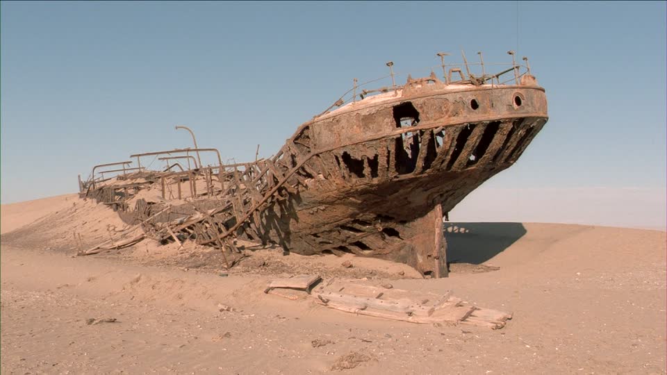
Skeleton Coast National Park
The Skeleton Coast is a 40 km wide and 500 km long stretch of coast in Namibia. Here the cold Benguela Current of the Atlantic Ocean meets the dune and desert landscape of north-western Namibia. This area probably got its name for the large numbers of stranded whales whose skeletons can be seen littering the coast.
A number of ships have stranded at the Skeleton Coast due to thick fog, rough seas, unpredictable currents, and stormy seas.
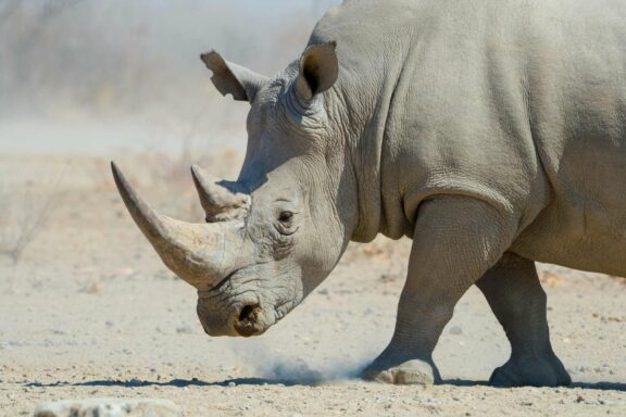
Despite its hostile character, the Skeleton Coast supports a diverse array of wildlife, including desert-adapted elephants, rhinos, desert lions, brown hyenas, jackals, giraffes, seals, oryx, kudu, and zebras.
The Skeleton coast is divided into two parts: the southern part and the northern part. The southern part stretches from the Ugab River up to Torra Bay, and is freely accessible. You’ll need a permit at the entrance gates at Ugabmund and Springbockwater.

The northern part from Torra Bay up to the Kunene at the Angolan border is not accessible and can only be reached with a tour operator holding the concession and qualification.
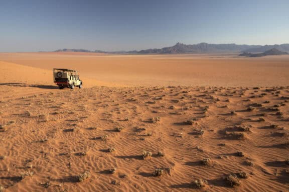
Sossusvlei and Dead Vlei
In the Namib Naukluft Park, in the middle of the Namib Desert, you’ll find two scenic highlights: the Sossusvlei and Dead Vlei. The Sossusvlei is a salt-clay pan surrounded by dunes. 60 000 years ago, the Tsauchab River is presumed to have flowed into the Atlantic Ocean.
Thanks to the sanding up and cutting off of the river, the 50 km to the Atlantic consists of different vleis, of which Sossusvlei is the best known.
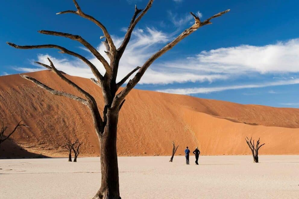
About every ten years, after exceptional rains, the Tsauchab fills the clay pan with water and forms a lake, providing a beautiful contrast to the surrounding dune landscape.
Close to Sossusvlei lies Dead Vlei. This vlei has long been cut off from the Tsauchab River and the result is a large amount of dead camelthorn trees which have avoided decay thanks to the extremely dry environment. At the edge of Dead Vlei is ‘Big Daddy’, assumed to be the highest sand dune in the world.
Spitzkoppe
Due to its distinctive form, which can be seen from a great distance, the Spitzkoppe is often referred to as the ‘Matterhorn’ of Namibia. The Spitzkoppe is located about 120 km north-east of Swakopmund and is only 30 km away from the route between Usakos and Swakopmund.
The Spitzkoppe actually consists of two separate mountains: the large Spitzkoppe, which is 1728 m high, and the small Spitzkoppe, which is 1584 m high. These mountains are a paradise for hikers and mountaineers.
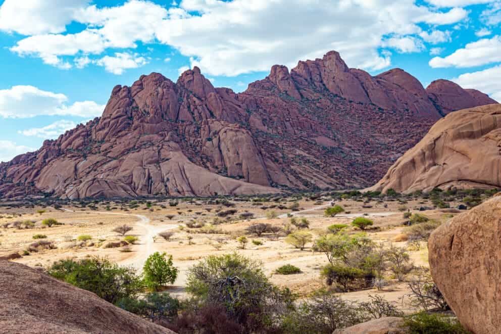
The first ascent of the challenging west side occurred in 1946 and to this day only 600 roped parties have managed to reach the peak. Hundreds of rock paintings can be found all around the Spitzkoppe, and the Rock Arch has featured as a backdrop in numerous films.
Feral Horses of Garub
A fascinating attraction in the southern part of the Namib are the feral horses of Garub. These horses are descended from domesticated horses that arrived during the colonization, but have adapted to the harsh climate and live independently of humans.
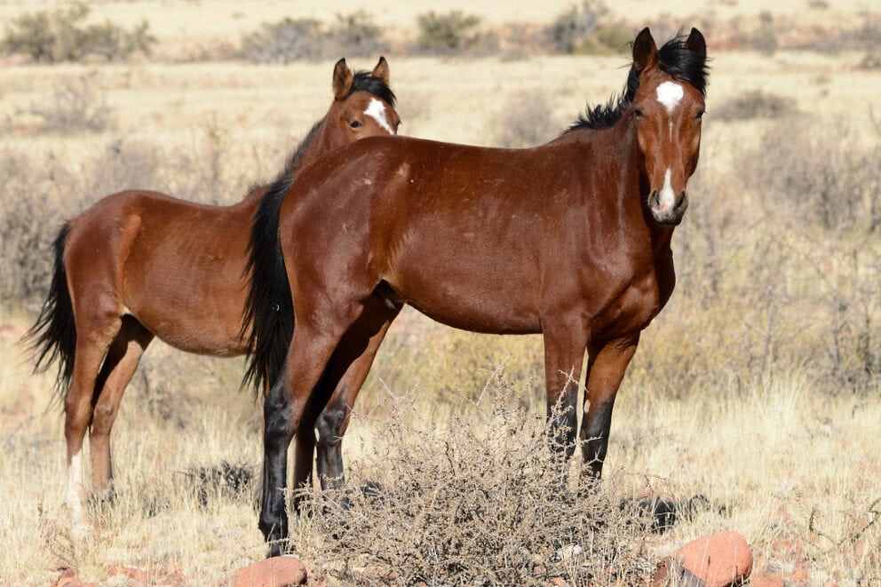
The horses can be viewed from a shelter close to a water hole. Today’s population is somewhere between 250 and 300 animals. To get to Garub, travel along the B4 from Aus to Lüderitz. 20 km behind Aus, a small gravel road leads to the water hole and viewing shelter.
Twyfelfontein
Twyfelfontein is where you can find 2500 rock paintings and rock engravings (petroglyphs) created by the San (Bushmen) between 1000 and 10000 years ago. What makes it even more remarkable is that the engravings were produced without metal tools.
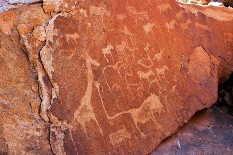
Instead the San people used quartz tools and many quartz chips have been found here. The rock engravings depict hunting scenes, in which the hunters are pictured with a bow and arrow, and animal engravings. Unusual is an engraving of a seal, as the ocean lies about 100 km away from the site.
The valley was declared a national monument in 1952 and UNESCO declared it a World Heritage Site in 2007. Note that the paintings and engravings can only be visited with a local guide.
Vingerklip
Located halfway between Outjo and Khorixas, the Vingerklip stands like a monument. This vertical protrusion is one of Namibia’s most famous rock formations. The Vingerklip is a geological leftover of a Ugab Terrace and stands at 35 m high.
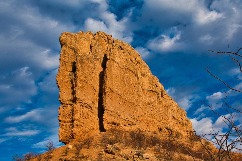
Visitors are permitted to view the rock formation but climbing the Vingerklip itself is prohibited. To reach the Vingerklip, drive along the C39 from Outjo towards Khorixas, then turn left onto the D2743 after about 70 km and follow the Vingerklip sign.
Von Bach Dam
The Von Bach Dam is situated about 60 km north of Windhoek and 5 km southeast of the town of Okahandja. The dam is fed by the 460 km long Swakop River, which flows into the Atlantic Ocean near Swakopmund, and has a capacity of about 49 million m³.
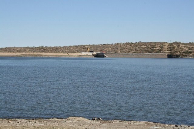
Not only is it an important reservoir and the main water supply for Windhoek, it’s also the center of the Von Bach Recreation Area at the foot of the Eros Mountains. Von Bach Dam is surrounded by a game park and a variety of water sports are offered.
Welwitschia Mirabilis
The Welwitschia Mirabilis is endemic to the Namib Desert in Namibia and Southern Angola. The plant is named after the Austrian botanist, Friedrich Welwitsch, who ‘discovered’ the plant in 1859. What makes these plants remarkable is that some specimens are estimated to be around 1000 and 1500 years old.
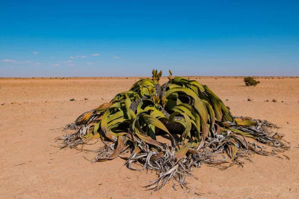
A particularly ancient and famous specimen can be found close to Swakopmund at the end of the Welwitschia Plains.
Written by Gavin Denner
• Travel Writer

Verified by Devryn Panaino
• Africa Safari Expert
Discover the African Journey that’s Right for You


Written by Gavin Denner
• Travel Writer
Verified by Devryn Panaino
• Africa Safari Expert
Part of the Namibia Safari Collection